|
Norway : Nord-Trøndelag
10.1 km (6.3 miles) NNW of Bjørhusdalen, Nord-Trøndelag, Norway
Approx. altitude: 482 m
(1581 ft)
([?] maps: Google MapQuest OpenStreetMap ConfluenceNavigator)
Antipode: 65°S 167°W
Accuracy: 1 m (3 ft)
Quality: good
Click on any of the images for the full-sized picture.
| 65°N 13°E (visit #1) | (secondary) |
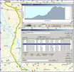
 (visited by Frank Dahlslett, Magnus Dahlslett and Stian Dahlslett) 30-Jul-2004 -- After a rather cold summer (below 15 degrees C) the sun once again surprised us by bringing the temperature up above 20 degrees in the beginning of the week and the weather forecast for the coming days was superb, too. This gave my son Magnus and me a feel of need for a trip out in the wild open. The confluence N65 E13 had not yet been visited, so this soon became a natural goal for an extended weekend trip. The confluence is located 270 km north of the Trondheim, the city where we live. I had previously noticed that another confluence hunter had plans to visit this spot during July or August so I had to send him an e-mail a couple of days ahead, to inform him that we had the same intension (this is according to the rules). Friday (30 July) turned up without getting any reply, so we took off from Trondheim (3. largest city in Norway) at 10:30, driving north. On our way, at Grong on E6 highway, we picked up a relative (male cousin of Magnus), making the N65 E13 team a triumvirat. At 15:00 we parked our car at Bertilsætran, 6 km west of the village Namsskogan, and started walking towards the confluence, which was 6 km away. The temperature was now 25 degrees and the sky was clear. Crossing some small rivers, then some moors and walking trough the forest, we then started ascending a hilly mountain up to 510 meters height (Litlfjellet). Just behind this peak we found a nice pond in a stream. We could not resist jumping into this 1-meter deep pool for a refreshing cool swim. The mild breeze then dried us and we could carry on the very last km to the confluence, where we had a late lunch. The pleasant trip had taken 3 hours (2.1 km/h) and we then rested for 30 minutes. We still had time for taking beautiful scenery snapshots to prove our new conquest (and also found time for telling some good jokes, too). The trip back was a piece of cake, using only 90 minutes (4.2 km/h) for the walk back to the car. After another 90 minutes of driving we came to the city Namsos where we spent two more days, staying together with our relatives (my brothers family) on this very warm and memorable extended weekend. The N65 E13 trip inspired us for yet another confluence hunt during the coming autumn. Just guess where? |
| All pictures |
| #1: N65 E13 panorama #2: View north #3: View east #4: View south #5: View west #6: The track to N65 E13 #7: The N65 E13 team #8: Just to be absolutely sure that we found the correct confluence! #9: A refreshing swin in the stream pond behind Litlfjellet #10: Overview map. We had to pass a protected nature reserve on our way. ALL: All pictures on one page |


![Visit #3: [05-Jul-16] Visit #3: [05-Jul-16]](/no/all/n65e013v3/preview.jpg)
![Visit #2: [11-Aug-04] Visit #2: [11-Aug-04]](/no/all/n65e013v2/preview.jpg)